Shorter Bike Trips (40 - 90 km)
Quicklinks
Longer Routes (80 - 150 km) - Long-Distance Routes (several days)
The following bike trips have been recoreded with a Garmin Edge 800 bike navigator. They are available as GPS tracks in *.gpx format which can be read by most GPS devices. You can also use the maps created with Google Maps on GPS Visualizer, a very confortable tool to create maps from GPS tracks in different formats. Most tracks are located in or around Berlin. Almost all the bike trips described here are suitable for trekking bikes. At least parts of them may however include unpaved roads and therefore might be somewhat difficult for racing bikes.
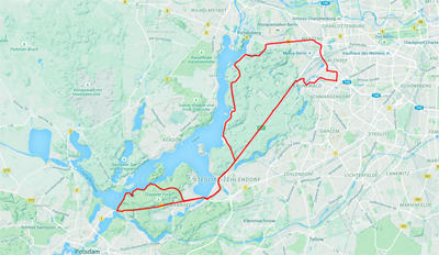
Round Trip Wannsee - Havelchaussee
Distance: 45.3 km - Uphill: 310 m - Downhill: 310 m
Download GPS track - open Google map
Round Trip around Tegeler See
Distance: 56.1 km - Uphill: 190 m - Downhill: 190 m
Download GPS track - open Google map
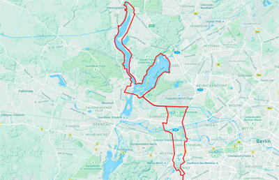 |
Quite easy, the track follows the bike routes on small, but mostly paved paths and only touches streets now and then. Part of the tour uses the Berlin-Copenhagen bike route and part of it follows the former soldiers lane directly behind the Berlin wall (Berliner Mauerweg). |
Round Trip Mauerweg West - Wasserstadt Spandau
Distance: 50.7 km - Uphill: 220 m - Downhill: 220 m
Download GPS track - open Google map
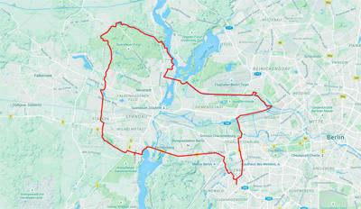 |
The track follows the western Mauerweg after leaving the city center of Berlin via Heerstraße to Pichelsdorf. Beyond Eiskeller, one of the former enclaves of west Berlin in the German democratic republic, it turns east to meet the Berlin-Copenhagen bike route back into the city through the Wasserstadt Spandau. |
Round Trip Mauerweg Nord - Berlin - Staaken - Schönwalde - Frohnau - Hennigsdorf - Märkisches Viertel - Prenzlauer Berg - Bernauer Straße
Distance: 84.1 km - Uphill: 367 m - Downhill: 309 m
Download GPS track - open Google map
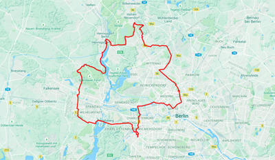 |
The track follows the western and northern Mauerweg between Spandau-Staaken and Bernauer Straße. The quality of the pavement is not always good. So do not bring your racing bikes. |
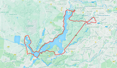
Round Trip around Wannsee
Distance: 63.0 km - Uphill: 370 m - Downhill: 370 m
Download GPS track - open Google map
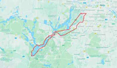
Round Trip around Schwielowsee via Potsdam and Caputh
Distance: 77.7 km - Uphill: 378 m - Downhill: 378 m
Download GPS track - open Google map
Round Trip Potsdam - Ketzin - Wustermark - Dallgow - Spandau
Distance: 82.1 km - Uphill: 406 m - Downhill: 406 m
Download GPS track - open Google map
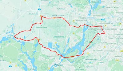 |
A tour more for training purposes rather than sightseeing, although you can include stops at different palaces in Potsdam and, on the way back to Berlin, might visit the Olympic Village from 1936. |
Elbe River Bike Route from Dessau to Wörlitz and Wittenberg
Distance: 42.0 km - Uphill: 189 m - Downhill: 119 m
Download GPS track - open Google map
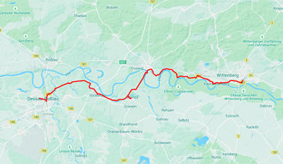 |
This trip connects the Bauhaus in Dessau including the Master Homes with the birthplace of German classicism in Wörlitzer Park and Lutherstadt Wittenberg with its Schlosskirche and Luther's home. The bike tour mainly follows the official Elbe river bike route. Good train connections between Berlin and Dessau or Wittenberg are available. |
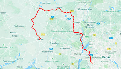
Berlin - Hennigsdorf - Kremmen - Nauen
Distance: 85.4 km - Uphill: 183 m - Downhill: 146 m
Download GPS track - open Google map
Round Trip Berlin - Tegel - Schönwalde - Eiskeller - Falkensee
Distance: 67.6 km - Uphill: 185 m - Downhill: 156 m
Download GPS track - open Google map
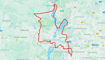 |
A round trip connecting the area around Lake Tegel with part of the Mauerweg at the former western border of Berlin. |

